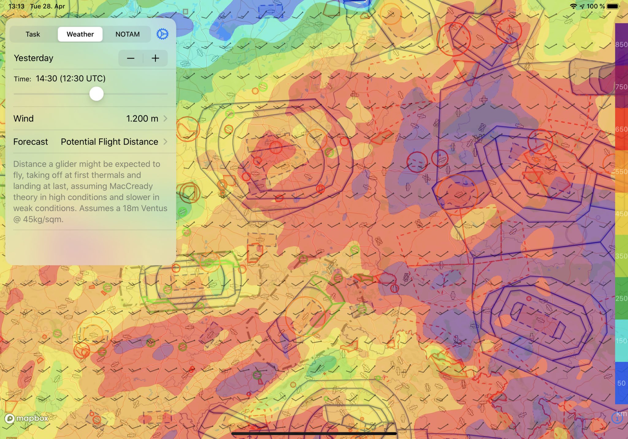
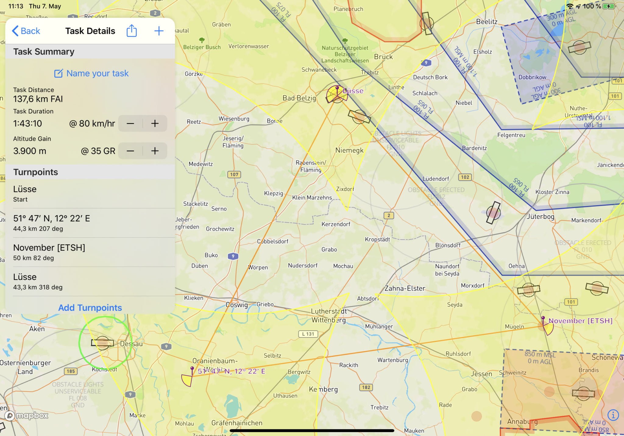
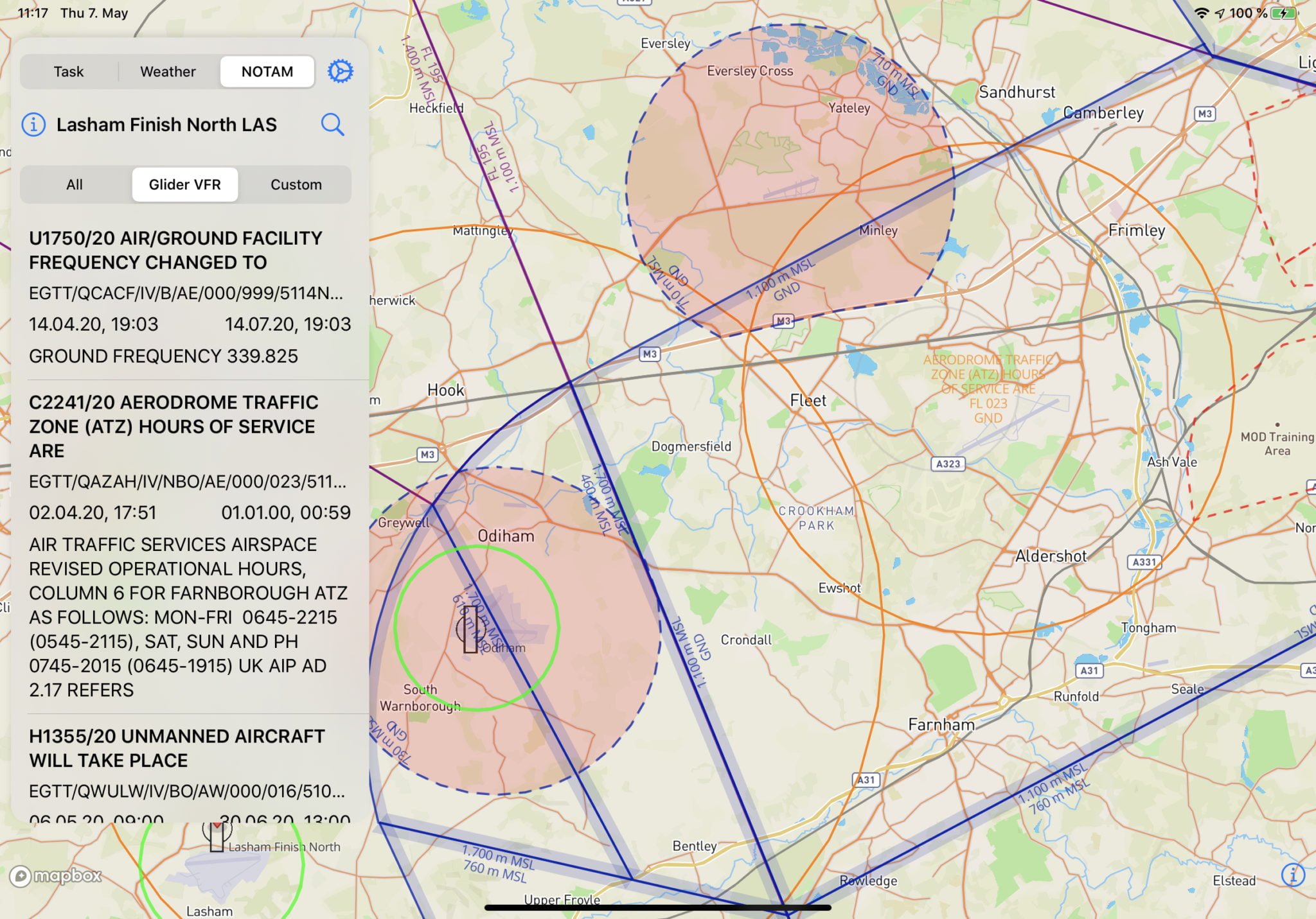
Cut flight planning time from hours to minutes. Plan safer, longer, and more enjoyable cross-country flights with real-time weather data and integrated airspace information.
Proper preparation is key for a safe, fun, long and fast cross-country flight. Aufwind is the iOS app that makes professional flight preparation effortless.
Professional-grade tools trusted by thousands of soaring pilots worldwide
Get the most crucial soaring forecasts built right into the app. Never get caught off-guard by changing conditions again.
Connect your SkySight account for even more detailed professional forecasts and thermal predictions.
Plan your cross-country route interactively with weather forecasts, airspaces, and waypoints overlaid on an intuitive map interface.
Access thousands of built-in waypoints or import your own. Export completed tasks to SD card or email for your flight computer or XCSoar.
Stay informed about local airspaces and NOTAMs to maximize flight safety. Avoid violations and plan routes that keep you legal and safe.
Pre-loaded airspaces for many countries, with support for importing your own OpenAir format airspace files.
"Aufwind has completely transformed my pre-flight routine. What used to take 2-3 hours now takes 20 minutes, and I'm more confident about my weather decisions."
"The SkySight integration is brilliant. Having professional weather forecasts right in the task planner saves so much time and improves safety."
"Finally, an app that understands what glider pilots actually need. The airspace awareness features have saved me from several potential violations."